Detecting icebergs using altimetry to help marine safety
Image of the Month - December 2024
August-November 2024 animation of iceberg detection between Drake Strait and East of Kerguelen Island ( 90°W - 80°E) overlaid on multi-sensor SST (processed by CLS). These detections were processed in the frame of the 2024 Vendée Globe round-the-world alone sail race, to help in defining a no-go area (because of high risks of iceberg encounters). This quadrant see a lot of icebergs detached from the Antarctic Peninsula in particular, and more broadly from the Weddell Sea coasts ending in areas of the Antarctic Circumpolar Current where sailors are likely to pass. White dots are altimetry detection (operational CLS detection in 2024), Black are SAR detection, dots Sentinel-1 wavemode (systematic monitoring), + on-request imagery (Sentinel-1 & Radarsat-2). Purple dots are optical imagery (MODIS, VIIRS, S3/OLCI). Pentagons are large tabular platforms tracked by US Natice center.). (Credit CLS for the animation)
July 2020 - October 2024. Same legend, credit and data sources, except: Ifremer Altiberg database till end of 2023 for the iceberg detections by altimetry
As every four years, the Vendée Globe round-the-world alone sail race left France early November. Early December they have reached for most of them the Southern Ocean, with one of the hazzards of this kind of travel: icebergs.
Satellite altimetry can detect icebergs under the satellites' tracks. This is not the whole of the icebergs at a given time - due to revisit time, space between the tracks, and limitation on the size of the icebergs detected. With these information, statistics and climatologies can however be done (see Image of the Month...). But it can also be used as a first approach to detect the areas where there may be icebergs. Then imagery techniques, optical - when by day and without clouds -, or SAR satellites can be focused to the more likely iceberg-prone areas, to have a more precise view on the situation. With ocean current modelling, the detected icebergs path can then be computed for a given period in the future, thus enabling to either issue immediate warning, or, as in the case of the Vendée Globe sail race, to define a "no-go" zone where there is high risk of encountering an iceberg which can severely damage a ship.
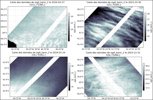
In the future, Swot should help in detecting more icebergs than the classical altimetry, with a much better spatial coverage. It is not a straightfoward process, though, since the geometry of the radar swaths and of the icebergs can generate different rendering in the data and, moreover, other phenomena can provide with similar images.
See also:
- Image of the Month, September 2016: The Silent World disturbed by icebergs' noise
- Image of the Month, September 2013: Icebergs on the move
- Image of the Month, November 2008: Counting icebergs
- Applications: Ice sheets and sea ice
- Data: Waveforms
Other website on this subject:
- The Altiberg climatological database of past icebergs' location is available throught Ifremer's Cersat center, see data description
References:
- Mercier F., Viard J., Legeais J., Calvez MH., Iceberg detection in the Southern Ocean based on a multi-sensor approach, 30 Years of Progress in Radar Altimetry Symposium, Montpellier (France), 2-7 September 2024
- Tournadre, J., N. Bouhier, F. Girard-Ardhuin, and F. Rémy (2016), Antarctic icebergs distributions 1992–2014, J. Geophys. Res. Oceans, 121, 327–349, doi:10.1002/2015JC011178.


